Laser-scanner surveys and services tool of rock slope
by Alfredo Gaspari
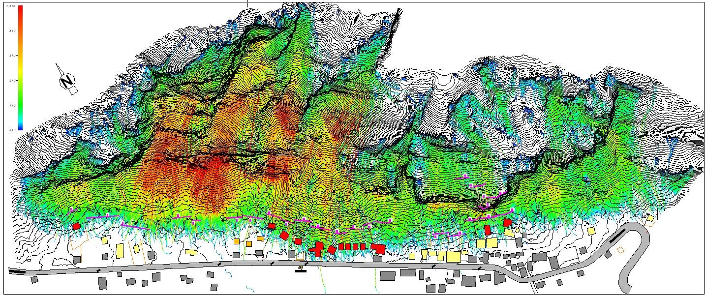
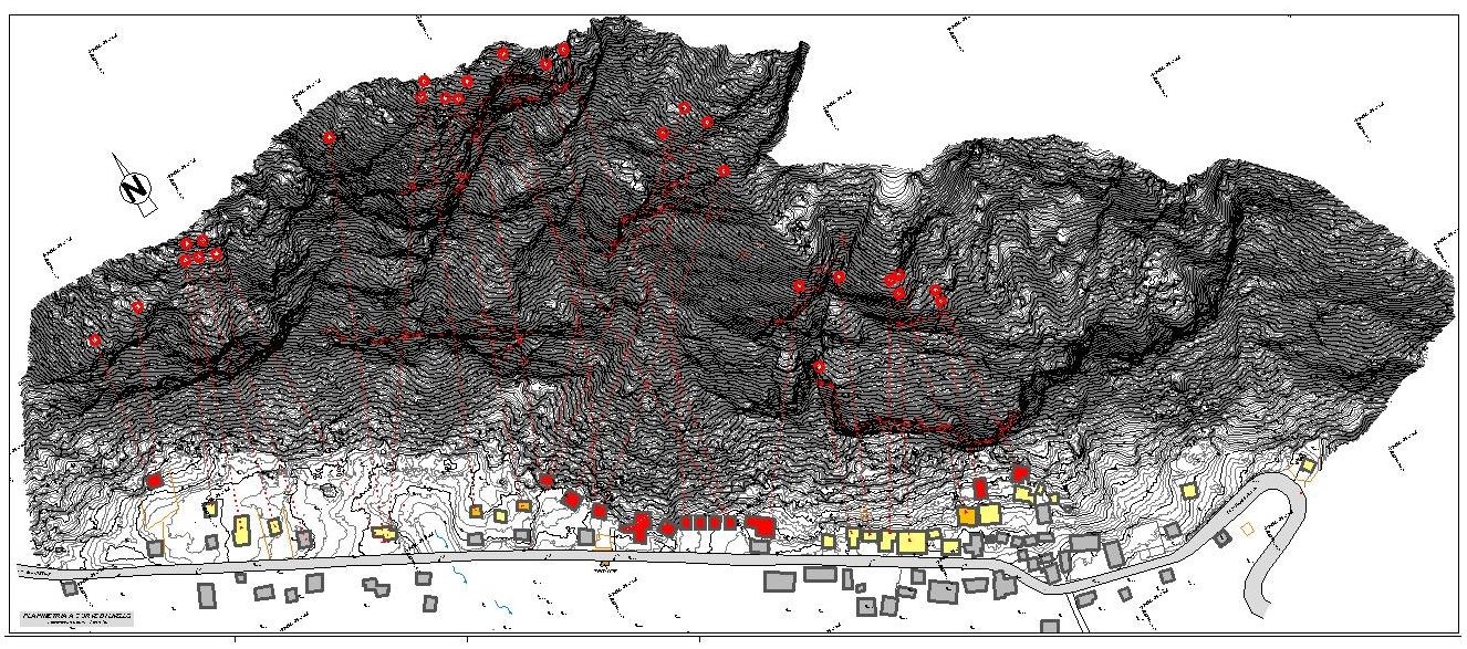
For the design phases of rockfall protection systems the designers have applied the laser-scanner of the cliff surveys for an area of 30ha and geomechanics tool analysis, in particular:
* Planimetric view and section;
* Polar diagrams and definition of joints (dip, diving, direction, spacing);
* Identification of unit rock volumes (VRU) and unstable rock masses;
* Mapping of areas of instability according to Markland test;
* 3D rockfall trajectories analysis.
.jpg)